
These village walks are just as much about the cafés as the countryside
The best walking days in the UK aren’t always the big mountain routes. They’re the ones where you can step off a train in a small village, follow a footpath straight from the centre, and know there’s somewhere to sit down with a pot of tea at the end of it. No complicated planning, no driving between trailheads. You just start walking.
On routes like the path out of Grasmere toward Rydal Water, the path leaves the village almost immediately. You pass stone walls, small farms, and open fields, and within minutes you’re away from the road. When you loop back, you can sit down at Baldry’s Tea Room for tea and cake before the next bus or train.
Further south, the walk from Amberley through the chalk hills of the South Downs National Park starts right by the station. You can follow the path up to Amberley Mount, with views across the valley, then come back down toward the river and end at Riverside Tea Rooms near the bridge. You don’t need a map or a car; the route is well marked, and the village is small enough that you always end up back where you started.
What makes these walks work so well is how easily the day falls into place. You get off the train, start walking almost straight away, and follow a route that’s easy to stick with without checking your phone every few minutes. When you’re ready for a break, there’s a café or tea room already on the way, not miles off route.
And don’t forget that picnic stops often end up being more memorable than the walk itself, and this guide to Oxfordshire villages gives you a few places where it actually makes sense to pause properly.
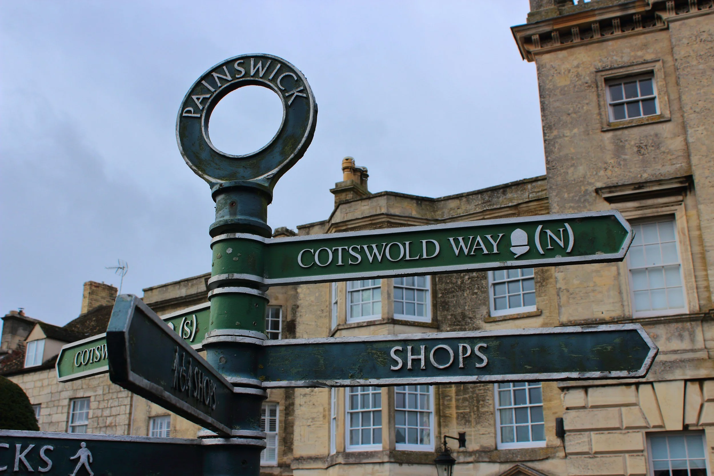
The Cotswold Way: rolling hills, village paths and proper tea stops
The beauty of walking the Cotswold Way is that you don’t have to commit to the full 100-plus miles to get a good day out of it. Some of the nicest sections start right from the middle of a village, so you can step out of a café and be on a footpath within minutes.
One of the easiest places to start is Broadway. From the High Street, you walk up past rows of honey-coloured stone cottages and follow the signed path that climbs steadily toward Broadway Tower. The climb is steady rather than steep, and it takes around 45 minutes to an hour at a relaxed pace. The higher you go, the more the views open up across farmland and low hills, and once you reach the tower, you get a wide view over the countryside. There’s a small café by the tower where people usually stop for tea or something simple before heading back down.
You can return the same way or follow one of the circular routes that loop back toward the village through open fields and along farm tracks. The whole walk usually takes two to three hours, depending on how long you stop at the top. When you get back to the village, you don’t have to search far for somewhere to sit down. The Broadway Deli is a popular stop for coffee, cakes, or something more substantial, and it’s normal to see walkers coming in straight off the trail.
Another good section of the route is near Winchcombe. From the centre of the village, the path climbs out through fields and hedgerows toward Belas Knap Long Barrow, an ancient burial site set into the hillside. The climb is steady but manageable, and the route is clearly marked. At the top, you get wide views over the surrounding countryside, and the walk back down into Winchcombe is gentle and easy to follow.
Back in the village, there are several places to stop for food or a drink. Around North Street and High Street, you’ll find cafés and small pubs that are used by locals as well as walkers. It’s easy to drop in without a reservation, especially on weekdays or outside peak summer.
What makes this part of the Cotswold Way work so well is the way the walking routes connect directly with the villages. You don’t need a car to reach the start of the trail, and you don’t need to plan complicated transport to get back. You can walk straight out from the village, follow the path, and end up back somewhere with a café or a pub within a few hours, which makes it easy to enjoy a proper walk without turning it into a big logistical exercise.

South Downs Way: open ridges, chalk paths and proper pub stops
The South Downs Way is one of the easiest long-distance trails in England to dip into for a day, because so many sections pass directly through villages or close to train stations. You don’t need a car to get onto the route, and you don’t need specialist gear. You can step off a train, follow the signs for the trail, and be out in open countryside within minutes.

One of the most practical places to start is Amberley. The station sits right by the river, and you can walk from the platform to the trail in under five minutes. From there, the route climbs gradually onto the Downs, following chalk tracks and grassy paths with views stretching across the valley. The path is clearly marked with acorn symbols, so navigation is straightforward. After the climb, you walk along the ridge before dropping back down toward the river. When you return to Amberley, the Riverside Tea Rooms by the bridge is a natural place to stop for tea or something warm.
Further east, another good access point is Alfriston. The village sits just off the trail and makes a useful stop if you want a shorter walk or a base for the night. From the village, you can follow the path up onto the Downs toward the chalk cliffs above the coast. The route climbs steadily at first, then levels out into open grassland with long views. Back in the village, you’ll find several places to eat along the High Street. Badgers Tea House is a reliable spot for tea, cake, or a simple lunch before or after your walk.
This part of the South Downs Way works well if you want a proper countryside walk without committing to a full multi-day hike. You can reach the trail easily by train, walk for a few hours on clearly marked paths, and finish somewhere with a café or pub. The landscape stays open and wide for most of the route, and because the trail passes close to villages rather than through remote terrain, it’s easy to adjust your plans depending on how far you want to go.
If you’re leaning toward the coast rather than inland trails, these English coastal villages give you the same slower pace with cafés and sea views built into the day.

South Downs Way

The coziest inn you can imagine: The white hourse
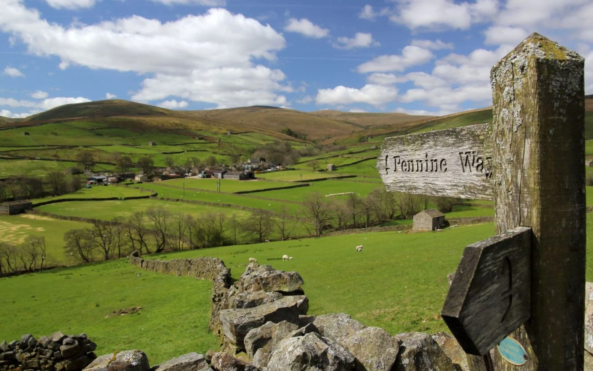
The Pennine Way: A rugged adventure through northern England
The Pennine Way runs straight through some of the most open countryside in northern England, and one of the easiest ways to experience it without a car is by basing yourself in one of the small towns along the route. A really good starting point is Hawes, right in the middle of Wensleydale. You can arrive by bus, get off near the centre, and walk straight onto the trail in minutes.
From the middle of Hawes, head toward the old stone bridge on Gayle Lane, cross the river, and follow the signed footpath toward Hardraw Force. The walk out to the waterfall takes about 30 minutes at a steady pace, and the entrance to the falls sits behind the Green Dragon Inn. You actually pass through the pub courtyard to reach the path, which is one of those small local details you wouldn’t know unless you’ve done the walk. The waterfall is tucked into a rocky amphitheatre, and it’s one of the few places in the area where you feel properly enclosed by the landscape rather than looking out over it.
If you want to stretch the walk further, continue uphill from Hardraw to rejoin the Pennine Way proper. The route climbs steadily out of the village, and once you’re above the fields, the views open across the valley. The path is clear but exposed, so if the wind picks up you feel it immediately. It’s the kind of walk where layers matter, even on a mild day.
Further north, another good section starts from Middleton-in-Teesdale. From the centre of the village, follow the riverside path toward Low Force Waterfall. The route stays close to the water, passing through fields and patches of woodland, and it’s easy to follow without a map. From Low Force, you can continue upstream to High Force Waterfall, where the river drops sharply over dark rock. There are a few narrow sections and stone steps along the way, so proper shoes make a difference, especially if the ground is wet.
Both Hawes and Middleton-in-Teesdale work well if you want to walk part of the Pennine Way without committing to a multi-day route. You can step out of your accommodation, be on the trail within minutes, and return to the village in time for food. In Hawes, cafés and small shops line the main street, so you can pick up something to eat before or after your walk. In Middleton-in-Teesdale, most cafés and pubs sit along the main road, which makes it easy to stop without planning ahead.

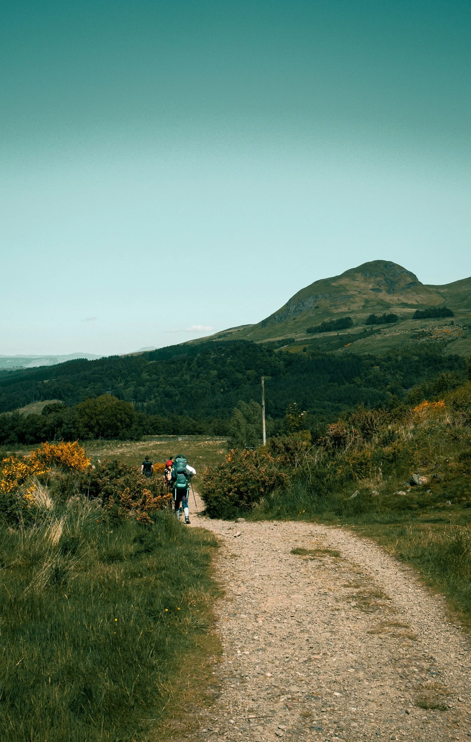
West Highland Way: an easy, car-free section through Scotland’s Highlands
You don’t need to walk the entire West Highland Way to get a real feel for it. One of the most accessible stretches starts in Tyndrum, a small village where the train stops right beside the trail. You step off the platform, cross the road, and you’re already on the path heading north through the valley. There’s no need to plan transport or arrange lifts; the route runs straight through the village.
Leaving Tyndrum, the path follows the old military road, gradually climbing through open valley with wide views of the surrounding hills. The surface is mostly compact gravel with some rocky stretches, so you don’t need technical gear, just good shoes. After roughly 90 minutes of walking at an easy pace, you reach Bridge of Orchy, a small cluster of houses, a station, and the Bridge of Orchy Hotel. Most walkers stop here for something warm before deciding whether to carry on or catch the train back. Having the railway line so close to the trail means you can decide your route on the day depending on weather or energy levels.
If you want a greener and more sheltered route, another good section starts in Balmaha on the eastern shore of Loch Lomond. The path begins right from the village centre and follows the water through woodland. Parts of the track hug the shoreline with views across the loch, and there are short stretches where you’ll step over exposed tree roots or stone steps. The walk isn’t difficult, but it does ask for steady footing in places. Once you’re back in Balmaha, the The Oak Tree Inn is a reliable stop for food, whether you’re after a full meal or just something hot after a couple of hours outside.
One of the most useful things about this part of the route is the access. Both Tyndrum and Bridge of Orchy sit on the railway line, and Balmaha connects by local bus, so you can walk without worrying about arranging transport back. That flexibility matters here, because the weather can change quickly. A clear morning can turn into wind and rain by afternoon, and being able to cut a walk short or extend it without worrying about a car makes the day much easier to manage.
This stretch of the West Highland Way works well if you want open views, clearly marked paths, and somewhere to stop for food without having to commit to a multi-day hike. You can make it a half-day outing or stretch it into a longer walk, depending on how you feel when you get there.
Not every village on a train line actually feels calm once you arrive, and this guide to towns near London helps you avoid the ones that get busy by mid-morning.

West highland way
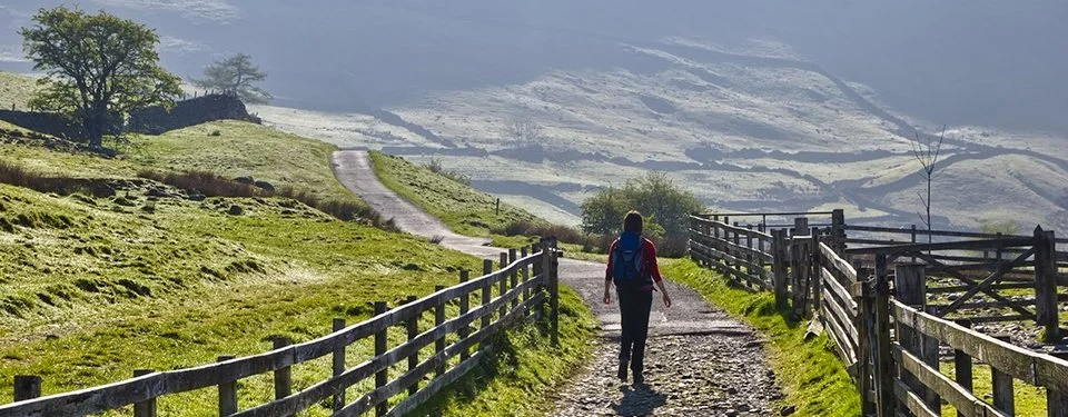
Coast to Coast Walk: village-to-village walking without a car
The Coast to Coast Walk is known as a long-distance route, but you don’t need to commit to the full crossing to get something worthwhile out of it. Some of the most enjoyable stretches sit right next to small towns, so you can arrive, walk straight out onto the trail, and be back in time for a meal without needing a car or complicated planning.
A good place to start is Kirkby Stephen. The train station is about a twenty-minute walk from the centre, but it’s a simple route along quiet lanes. From the middle of town, you cross the River Eden over Frank’s Bridge, a small stone footbridge tucked just behind the main street. This is where the path begins to climb toward the ridge. The route up to the Nine Standards Rigg is steady but manageable. You’ll pass open fields, stone walls, and long stretches of moorland before reaching the line of tall stone cairns at the top. The ground gets boggy in sections after rain, so waterproof boots make a difference. There aren’t cafés or shelters along this part of the trail, so it’s worth stopping at one of the bakeries on Market Street in town before you start.
Further east, Reeth makes another easy base. The village sits on the edge of the route, so you don’t need to arrange transport to reach the trail. From the green in the centre of Reeth, you can follow the riverside path toward Grinton, passing stone barns and open pasture. The route stays fairly level and follows the river for much of the way, which makes it one of the easier sections of the Coast to Coast Walk. Once you reach Grinton, you can cross the bridge and follow the lane back toward Reeth, creating a straightforward loop without needing to backtrack.
Back in Reeth, most of the places to eat and drink sit around the village green. The Buck Hotel serves pub meals through the afternoon, which works well if you finish your walk later in the day. There are also small tearooms and cafés along Silver Street where you can stop for something lighter before heading on.
What makes this stretch of the Coast to Coast Walk practical is how easily the route connects with the villages. You don’t need a car to reach the trail, and you don’t need to walk for hours before finding somewhere to sit down. You can step out from the centre of town, follow the path for a few hours, and return for a proper meal without worrying about transport.
Love small towns? Windsor often gets reduced to a quick stop, but looking at Windsor cafés changes how you use the town completely, especially if you’re planning a slower walking day.
Coast to Coast hike

Before you go
One of the biggest surprises when you actually do these walks isn’t the scenery, it’s how much the practical details shape your day. In places like Grasmere, mornings start early. If you want fresh bread or a quiet coffee before heading out, you go before 10:00, not late morning. The small cafés around the village green fill quickly on weekends, and by mid-afternoon many of them start winding down, especially outside summer.
In Amberley, most people walk straight from the station across the bridge over the River Arun and onto the Downs. It’s worth knowing that the path climbs quite quickly once you leave the river, so if you’re planning a longer loop, it’s easier to start early rather than later in the day. When you come back down, the tearoom by the bridge is often busy in the middle of the day but quieter mid-morning and later afternoon.
Up in Scotland, the train stops at both Tyndrum and Bridge of Orchy, which makes that section of the West Highland Way easy to do as a one-way walk. It’s worth checking the return train before you set off, because services thin out later in the day, and missing one can mean waiting a couple of hours for the next.
If you’re heading to Kirkby Stephen for the Coast to Coast Walk section, plan a quick stop in town before starting the climb. The small shops around Market Street are the last place to pick up water or food before the route heads up toward the ridge. The ground gets boggy in places after rain, so waterproof shoes make a real difference here, even on a short walk.
These routes work best if you don’t try to squeeze too much into one day. Check opening times locally, carry something for the weather, and allow a bit of extra time so you don’t have to rush. That way, the day feels easy rather than packed, and you actually get the kind of experience these places are good at delivering.
Longer walks start to feel different once you think about where the day ends, and these Scotland stays are a good reference if you want that same quiet, end-of-day atmosphere after being outdoors.
How do you reach these walks by public transport?
All of these walks can be reached by train or a short bus connection, which makes them practical even if you’re not renting a car.
For the Cotswold Way, the easiest access point is Moreton-in-Marsh. There are direct trains from London Paddington Station that take around 90 minutes. From Moreton-in-Marsh, buses run to Broadway, where you can start walking straight from the High Street.
For the South Downs Way, the most straightforward option is to take the train to Amberley. Trains run regularly from London Victoria Station, and the journey takes around 90 minutes. From Amberley Station, you can walk directly onto the trail within minutes.
If you’re heading to the Coast to Coast Walk, Kirkby Stephen is one of the most convenient access points. Trains on the scenic line between Leeds and Carlisle stop here, and from the station it’s a 20-minute walk into town where the trail begins.
For the West Highland Way, Tyndrum and Bridge of Orchy are the most practical starting points. Both have small train stations served by trains from Glasgow Queen Street Station. From the platforms, you can walk straight onto the trail without needing any transfers.
FAQ about village walks in the UK by train
What is the best section of the Cotswold Way without a car?
One of the easiest and most rewarding sections starts in Broadway and climbs to Broadway Tower. You can reach Broadway by bus from nearby train stations and start walking from the High Street. The route is clearly marked, and the return loop takes around two to three hours at an easy pace.
Where should I start the South Downs Way by train?
A practical starting point is Amberley. The station sits right beside the trail, so you can walk straight from the platform onto the South Downs Way. From there, the path climbs onto the Downs with wide views and well-marked routes, and you can return the same way or continue to the next village.
Can you do the Coast to Coast Walk as a day walk?
Yes. Around Kirkby Stephen, you can join the Coast to Coast Walk directly from the village. A popular option is walking up to Nine Standards Rigg and returning the same way. The climb is steady and the ground can be boggy after rain, so waterproof footwear helps.
Do I need a car to walk these routes?
No. All the walks in this guide start from villages that can be reached by train or bus. Once you arrive, you can reach the trail on foot within minutes. This is especially true in Broadway, Amberley, and Kirkby Stephen, where the trail runs close to the village.
Are these walks suitable for beginners?
Yes. These sections are well marked and don’t require technical hiking experience. There are climbs and uneven paths, especially on the South Downs Way and the Coast to Coast route, but the distances are manageable and there are places to stop for food or rest along the way.
When is the best time of year to do these walks?
Late spring to early autumn is the most practical time, as paths are drier and cafés and pubs are open more consistently. Spring is especially good if you want quieter paths and cooler walking conditions.
Where can I eat along these routes?
Each route passes close to cafés or pubs. In Broadway, you’ll find several places to eat along the High Street. In Amberley, there’s a tea room near the river bridge. In Kirkby Stephen, cafés and small pubs cluster around the town centre, making it easy to eat before or after your walk.